
The Qinghai-Tibet Highway: Driving the Roof of the World (2026)
Driving the Qinghai-Tibet Highway — the route from Xining to Lhasa, the plateau landscapes, the altitude, and how to plan the road trip of a lifetime.
OpenStreetMap Google Maps (opens externally)
The Qinghai-Tibet Highway is the road trip of a lifetime — 2,000 km across the roof of the world, from Xining to Lhasa through the lakes, the passes and the snow mountains of the plateau. Here’s the complete guide.
For over fifty years, the Qinghai-Tibet Highway has carried travelers to the roof of the world — the sealed road that crosses the Tibetan Plateau from Xining to Lhasa, through the lakes, the grasslands and the passes that define the highest land on earth. It’s the most accessible of the great Tibet roads, and it’s a journey of a lifetime: the altitude, the distances and the landscapes combining into an experience unlike any other. This guide covers the route, the challenges and the planning.
The route
- Xining to Lhasa — about 2,000 km, the classic 4–6 day drive.
- Qinghai Lake — the great lake at the start of the journey.
- Golmud — the desert town at the heart of the route.
- The Tanggula Pass — the highest point, over 5,000 m, before the descent to Lhasa.
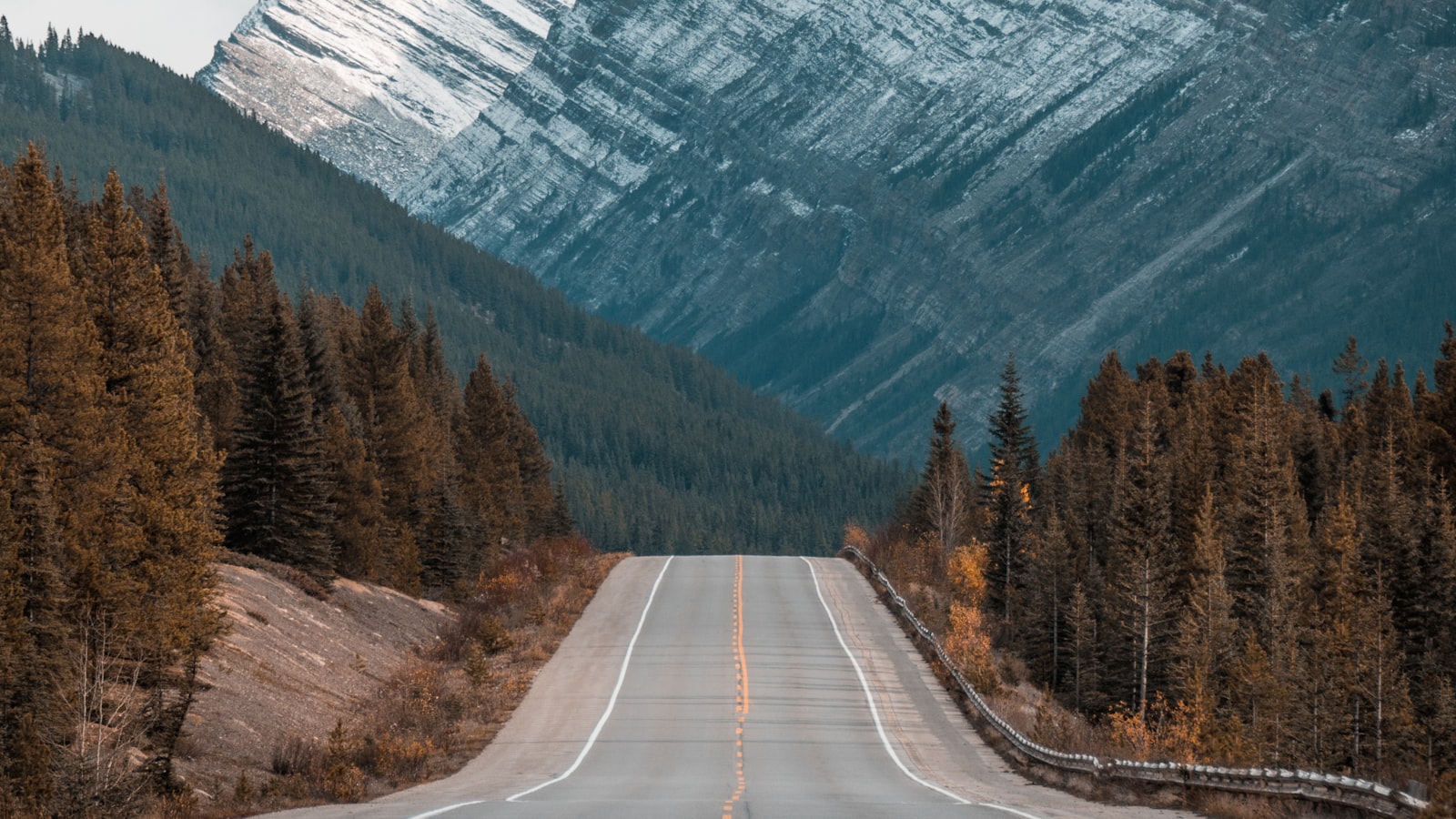
The route crosses the heart of the plateau — a rolling panorama of the greatest high-altitude landscapes.
The landscapes
- The lakes — Qinghai Lake and the sacred lakes along the way.
- The grasslands — the herders’ country and the grazing flocks.
- The passes — the mountain crossings with their prayer flags.
- The mountains — the snow peaks on the horizon, and the approach to the Nyenchen Tanglha.
The plateau’s landscapes are the reward — the lakes, the grass and the mountains of the roof of the world.
The challenges
- The altitude — above 4,000 m for much of the route; the defining factor.
- The distances — the long drives between the towns and the stops.
- The permits — Tibet’s permit structure, handled through the organized tours.
- The weather — the passes close in winter; the season matters.
The challenges are real but manageable with planning — the organized structure and the altitude discipline make the road trip work.
The journey, in practice
- An organized tour — the driver, the vehicle and the permits, handled by the operator.
- The acclimatization — the start at Xining and Qinghai Lake before the high passes.
- The pace — 4–6 days, with the stops for the landscape and the altitude.
- The arrival — the descent to Lhasa and the completion of the road journey.
The journey is best taken slowly and with the organized structure — the plateau rewards the pace and the planning.
The road in stages
The Qinghai-Tibet Highway unfolds in distinct stages, and knowing them makes the journey comprehensible. From Xining, the road skirts the great blue expanse of Qinghai Lake — the largest lake in China — before climbing onto the plateau proper. Golmud, the desert town at the heart of the route, is the last real city before Tibet and the natural acclimatization stop. Beyond it, the road climbs through the Kunlun mountains and across the high grasslands to the Tanggula Pass — at over 5,000 meters the highest point of the whole journey — before descending through the herders’ country of northern Tibet toward Lhasa, with the snow peaks of the Nyenchen Tanglha rising ahead in the final approach.
- Xining and Qinghai Lake — the start, and the great lake at the route’s beginning.
- Golmud — the desert town and the last city before the plateau crossing.
- The Tanggula Pass — the highest point of the road, over 5,000 meters.
- The arrival — the descent to Lhasa and the mountains of the final approach.
The railway, the parallel
The highway is not alone in crossing the plateau — the Qinghai-Tibet railway runs alongside it for much of the way, and seeing the two together is part of the experience. From the road you watch the trains climb the passes, their pressurized carriages carrying passengers at the very heights of the plateau. The railway is the easier and faster way to make the crossing; the highway is the slower, closer encounter with the landscape. Many travelers take one each way, riding the rail to Lhasa and driving back (or vice versa), to see the plateau from both perspectives.
- The two routes — the road and the rail, side by side across the plateau.
- The higher speed — the train crosses in a day; the road takes its 4–6 days.
- The closer view — the road stops where the train only passes.
- The combination — one way by rail, one way by road, for both perspectives.
Packing for the drive
Packing for the Qinghai-Tibet Highway is packing for a moving weather system. The days can be warm and bright, but the altitude and the passes bring cold, wind and sudden changes at any time of year. The essentials are the same as for any high-altitude trip, with a few additions for the road: layers and a warm hat and gloves for the pass stops, strong sun protection for the relentless plateau light, and a good supply of water and snacks for the long, empty stretches. Motion sickness tablets help on the winding passes, and a small bag of altitude medications, discussed with a doctor before you go, is a sensible addition.
- Layers and a warm hat — the pass stops are cold even in summer.
- Sun protection — the plateau light is fierce at altitude.
- Water and snacks — the long stretches between the towns demand supplies.
- The tablets — for the motion of the winding passes and the altitude.
The herders’ country and the plateau life
Beyond the scenic set-pieces, the highway runs through the living country of the Tibetan Plateau. The grasslands on either side of the road are the herders’ domain, dotted with the black wool tents of the summer camps and the flocks of yaks and sheep that move with the seasons. At the roadside, small markets and tea houses serve the truckers and the travelers, and the prayer flags flutter over every pass. It is a rolling, unhurried panorama of a way of life that has continued for centuries, and the stops along the way are as much a part of the journey as the great views.
- The herders’ camps — the black tents and the flocks of the plateau summer.
- The roadside stops — the tea houses and the small markets of the highway.
- The yaks and the sheep — the livestock of the high grasslands.
- The prayer flags — the blessings on every pass.
Budget and planning
The highway trip is best understood as an organized expedition: the operator handles the vehicle, the driver, the permits and the pacing, and the cost reflects the remote logistics — expect it to sit well above a standard Chinese road trip. The 4–6 day pace is the right frame, with the acclimatization stops built in. The season is fixed by the passes: May through October, with September and October the clearest window. It is a trip that rewards the serious traveler — the road across the roof of the world is not a casual drive, but it is one of the great journeys on earth.
- The organized structure — the vehicle, the driver and the permits, handled by the operator.
- The 4–6 day pace — the right frame for the altitude and the scenery.
- May–October — the season the passes are open.
- The reward — the great road journey across the roof of the world.
Practical notes
- Best season — May–October; September–October is often the sweetest.
- The altitude — prepare with our high-altitude guide.
- The permits — see our Tibet permit guide.
- Get connected — set up Alipay and an eSIM for the logistics.
The bottom line
The Qinghai-Tibet Highway is the road trip of a lifetime — 2,000 km across the roof of the world, from Xining to Lhasa through the lakes, the passes and the snow mountains. Go in the summer-to-autumn season, take the organized structure, respect the altitude, and drive the road that crosses the highest land on earth.
Last updated: August 2026. Road conditions, permits and access change — confirm current details before you go.
Frequently Asked Questions
What is the Qinghai-Tibet Highway?
The **Qinghai-Tibet Highway (G109)** is the road from Xining across the Tibetan Plateau to Lhasa — about 2,000 km of high-altitude driving, the classic road journey to Tibet. It crosses the lakes, the grasslands and the passes of the plateau, with the snow mountains on the horizon, and it's the most accessible of the great Tibet roads. It's a road trip of a lifetime — and the altitude, the permits and the logistics make it a serious one.
How hard is driving the Qinghai-Tibet Highway?
The challenges are real but manageable: the **altitude** (above 4,000 m for much of the route) is the defining one, and the **distances and the weather** demand planning. The road itself is sealed and drivable, with the towns and the stops along the way. Most travelers drive it with an **organized tour** (which handles the permits, the driver and the vehicle), rather than self-driving — the permits for Tibet make organized travel the practical structure. See our [high-altitude guide](https://chinotrips.com/how-to/outdoor-mustang-karoo/) for the altitude preparation.
What will I see along the route?
The route crosses the heart of the plateau: the **lakes** (Qinghai Lake at the start, the sacred lakes further on), the **grasslands** and the herders' camps, the **mountain passes** with their prayer flags, the **Golmud desert** at the center, and finally the climb to the **Tanggula Pass** — the highest point of the road — before the descent toward Lhasa and the holy mountain of Nyenchen Tanglha. It's a rolling panorama of the plateau's greatest landscapes.
How long does the journey take?
**Four to six days** of driving from Xining to Lhasa is the typical plan, with stops for the landscape and the acclimatization: Xining, Qinghai Lake, Golmud, the passes, and the final approach to Lhasa. The **4–6 day** pace allows the altitude to settle and the scenery to be enjoyed. It can be done faster, but the plateau rewards the slower pace — see our [Qinghai-Tibet route](https://chinotrips.com/itineraries/summer-qinghai-tibet-route/) for the seasonal version.
Do I need a permit for the Qinghai-Tibet Highway?
**Yes — Tibet requires a permit for foreign visitors**, and most travelers must be on an organized tour, with the permits and the logistics handled by a licensed agency. The highway enters Tibet partway through the journey, which is when the permit structure applies. This is fixed and non-negotiable. Book through a reputable operator well ahead, and let them handle the paperwork. See our [Tibet permit guide](https://chinotrips.com/visa/tibet-travel-permit/) for the details.
How does the altitude affect the drive?
The route stays **above 4,000 m for much of its length**, with the Tanggula Pass at over 5,000 m — the highest point. The thin air affects everyone: headaches, breathlessness and poor sleep are common. The rules are the same as any high-altitude trip — acclimatize at the start (Xining and Qinghai Lake), climb slowly, hydrate, and descend on symptoms. See our [high-altitude guide](https://chinotrips.com/how-to/outdoor-mustang-karoo/) for the full preparation.
When is the best time to drive the route?
**May–October** is the season — the passes are open, the weather is milder and the plateau is green. **September–October** is often the sweetest: clear skies and the autumn light. **Winter (November–April)** closes the passes and brings severe cold and snow — the route is not practical in winter for most travelers. For the road trip, the summer-to-autumn window is the time.